Maps & Virtual Globes | © Shutterstock

Maps &

Virtual Globes

When data is represented in cartographic form, rendering and user experience are essential to the proper dissemination of geographic information.

Camptocamp's interactive maps and virtual globes use innovative technologies to meet user expectations.

Maps & Virtual Globes | © Shutterstock
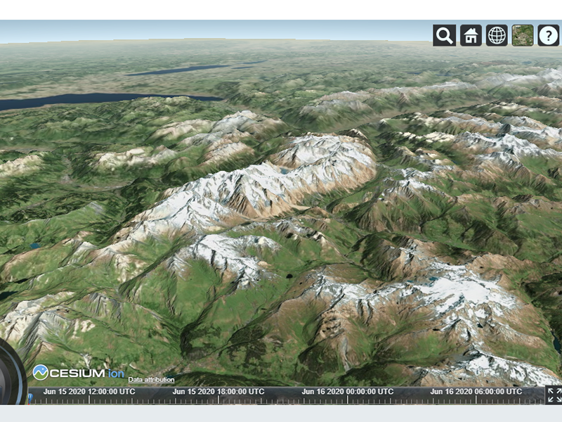
Zermatt - Matterhorn | © Camptocamp - Cesium

Seamless navigation...

... between 2D and 3D rendered scenes is a feature often asked for, and for which we are providing a dedicated library. Our solutions for 2D webmaps are created with OpenLayers, and the applications for 3D webglobes with CesiumJS.

Camptocamp's Mapping Library offers rich cartographic features and a great user experience. The solution can display billions of records on a map and dynamically style them based on very fine cartographic rules. Further, the mapping library even provides uncommon features to support your very specific cartographic needs.

The rendering features take advantage of the newest technology. It supports both Canvas and WebGL technologies, for maximum flexibility and performance. As active contributors to the libraries we support OGC standards as well as other industry standards such as MapBox Vectortiles or CesiumJS 3D tiles.

Zermatt - Matterhorn | © Camptocamp - Cesium

High performance web maps...

... are considered standard nowadays. We are offering our JavaScript mapping libraries for developers to integrate them in native applications for mobile devices, as well as desktop applications. Further, we are proposing multiple strategies to load data into the mapping application, whether the device is online or offline.  For live data provided by IoT devices, we propose solutions to constantly stream data into the application.

Our experts share their outstanding experience and help you solve your mapping challenges in any system architecture.
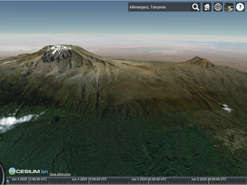
Kilimanjaro | © Camptocamp - Cesium

Areas of expertise

Geodata

Camptocamp offers an ecosystem of Open Source tools and AI-based algorithms for the collection, processing and integration of geodata.
Read more

Geospatial Analytics

Our experts support you in the analysis and understanding of your data, using geographic models and map dashboards.
Read more

Geospatial Information System (GIS)

We develop GIS applications based on QGIS to support your business needs. The possibilities are limitless.
Read more

Spatial Data Infrastructure (SDI)

Camptocamp offers a feature-rich, ergonomic and interoperable geographic data infrastructure.
Read more

IT Development

Beyond the GIS or ERP core, Camptocamp develops your entire IT project when Open Source technologies, expertise and agility are essential to the success of the project.
Read more

Customer Journey

Geospatial Solutions
Customer Journey Deutsche Telekom | © Deutsche Telekom

Deutsche Telekom

The rapid and nationwide expansion of the fiber optics network is a central cornerstone of Germany's Digital Agenda. The know-how of the IT company Camptocamp helps to achieve the ambitious goals.
Infrastructure Solutions
Customer Journey swisstopo | © swisstopo Logo

Federal Office of Topography swisstopo

Swisstopo hosts over 300 terabyte of geographic data in the cloud and makes it publicly available. For the federal authority to become a cloud pioneer, it took a lot of willpower, competent advice - and a stroke of luck.

Career

Interested in working in an inspiring environment and joining our motivated and multicultural teams?