Introducing Winter-Ready Tour Planning in SchweizMobil

Elisabeth Leu
At Camptocamp we’re proud to help SwitzerlandMobility (SchweizMobil) evolve into a modern, flexible platform for planning outdoor adventures. The SchweizMobil foundation maintains Switzerland’s national network for non‑motorised traffic – a dense network of signposted routes for hiking, cycling, mountain biking, inline skating and canoeing in summer and for snowshoeing, cross‑country skiing and sledging in winter. Their site and app provide free information about these official routes, enabling users to plan trips and link stages with accommodation and other services. Recently, Camptocamp worked closely with SchweizMobil to refresh the tour‑drawing tool and to expand winter route coverage. Here’s what’s new.
Assign activities with a single click
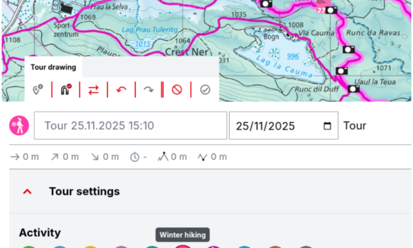
The activity selector is now directly aligned with the corresponding layers on the map, while using the drawing tool. When drawing a segment, you can freely choose whether it’s a hiking, cycling, mountain bike, snowshoe or cross‑country ski section, and have the map and snapping adapt according to it. The software adjusts speed profiles and ensures your total time estimate reflects the real effort. This makes it easier to share realistic tours with friends or simply keep track of how long different parts of your trip will take.
Snap along winter‑only routes
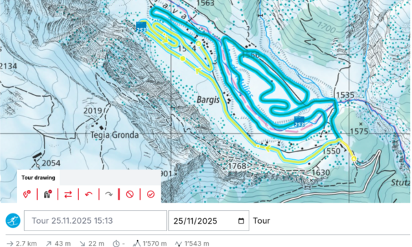
Winter sport enthusiasts will welcome the ability to draw and snap to winter routes that do not follow summer hiking paths or roads. Switzerland’s winter route network includes groomed cross‑country ski trails, sledging runs, snow‑shoe routes and other winter hiking paths that are set up temporarily each season. Until recently these routes could not be viewed or used as a base for drawing custom tours. Now, when you plan a tour on SchweizMobil, you can click on a winter trail and have your route automatically follow it. This works seamlessly with the activity selector: choose “snowshoe” or “cross‑country skiing” and the snapping engine will guide your line along the appropriate winter trail.
New winter networks for flexible planning
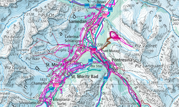
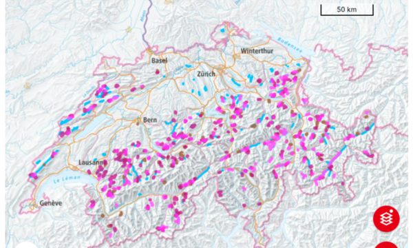
Beyond the signposted winter routes, many regions maintain local winter networks – prepared paths for snowshoeing or winter walking that are not part of the detailed route descriptions. These networks offer extra flexibility: you can plan off‑road loops, connect villages or create training circuits without being restricted to official routes. By incorporating these networks into the SchweizMobil map, the drawing tool now shows them as thin lines and lets you snap to them when you choose a winter activity. This opens the door to exploring new landscapes on groomed but less‑known paths.
Including these networks requires close cooperation with the SchweizMobil partners, who are working hard to provide more and more data during the coming winter months!
Snow depth on the map
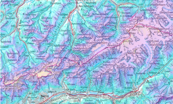
Planning winter activities isn’t just about finding the right path – it also requires knowing how much snow is on the ground. To help with this, the SchweizMobil map now includes a snow‑depth layer. When you enable this overlay in the map’s options, a colour gradient appears across the terrain, showing approximate snow depths from a few centimetres to several meters. With this information you can decide whether a trail is best tackled on foot, with snowshoes or on skis, and combine it with live route status to choose the safest and most enjoyable tour.
Working together for better outdoor experiences
These enhancements are a testament to the collaborative spirit between Camptocamp and the SchweizMobil foundation. SchweizMobil provides the authoritative route data and ensures together with their partners that routes are signposted and safe, while Camptocamp contributes expertise in open‑source geospatial technologies to turn that data into an intuitive digital experience. We thank SchweizMobil for making the data for the additional winter networks available and for trusting us to implement these new features. Whether you’re planning a snowshoe hike, cross-country skiing day or a mixed‑activity adventure, the updated drawing tool on SchweizMobil.ch makes it easier than ever.
Try it yourself
Visit SwitzerlandMobility’s winter map and experiment with the new drawing tool. Assign activities as you draw, snap to winter‑only trails and explore the extended winter networks. We’re excited to see the creative tours our users will come up with, and we look forward to continuing our partnership with SchweizMobil to keep improving the platform. Happy tour planning!
Author
Career
Interested in working in an inspiring environment and joining our motivated and multicultural teams?