Why use Mergin Maps?
When gathering data in the field, we often use pen and paper, or csv files. Once work is finished, we go back to the office to input the data into the database. This takes time and effort, especially if you have many people working on the same area, leading to conflicts and double entries.
If your team needs to collect data on the field and then directly synchronize it without waiting to get back in the office, Mergin Maps is the tool for you. A simple-to-use but complete mobile app enables you to build teams, customize and secure the data, while keeping it up-to-date.
Mergin Maps manages the infrastructure, synchronization, data process and more.
Feature overview:
- Easy to gather on-field information
- Real time geolocation
- Tracks user movement
- Photos and documents linked to location
- No need to re-enter information
- No conflicts
- Works offline
- Background layer (OSM, IGN, etc, cached)

The Mergin Maps ecosystem
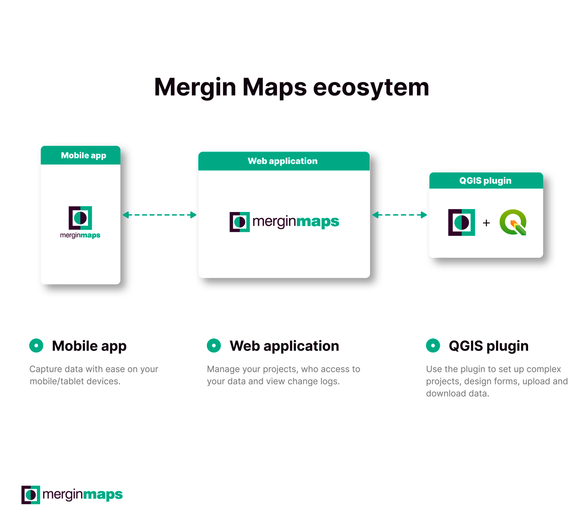
The Mergin Maps ecosystem brings together several tools to simplify your process from gathering data in the field to integrating into your database and dealing with many users.
The Mergin Maps plugin for QGIS allows you to work with your Mergin Maps projects. Whether it's downloading the project to your computer, making changes in the project, seeing the project's status or synchronizing changes to the cloud.
The cloud, aka the Mergin Maps web application, is used for synchronizing QGIS projects and data on your mobile device.
This application is available both on IOS and android.
Finally, a db-sync tool (optional) enables you to synchronize the data directly from the Mergin Maps application in your PostGIS database.
It will simplify your process, resolve conflicting data points, enabling experts to focus on the data.
Why work with Camptocamp?
Camptocamp can implement and maintain this full featured and robust system. We have the skills, time and energy to deal with infrastructure, security, hosting, and you just deal with data.
Camptocamp can help you in setting up the actual QGIS project, by using the power of expressions to build complex forms, the potential of constraints, and the potentiality of PostgreSQL’s triggers, in order to reduce time spent on the field and during post-processing, and, more crucially, making sure data is clean, accurate, and usable.
Also, Camptocamp can assist you with Mergin Maps training, support and hosting.
The benefits
- Simplify your workflow
- Delegate Mergin Maps management to an expert
- Focus on your expertise area
- Collect more, host less
Get in touch
Career
Interested in working in an inspiring environment and joining our motivated and multicultural teams?


